September 16 we hiked to Mt. LeConte via Trillium Gap. This was the last trail in our quest to hike the five trails to LeConte. This was our 6th hike to LeConte and the 4th time we stayed at the lodge.
I always told myself when we have all five trails completed, I will be satisfied with that and won't feel the need to hike it anymore.
Well........there's something about this mountain that keeps calling you back time and time again. It's more than just the beautiful views. It's the experience. It's a sense of physical accomplishment. In fact half of our hikes have been fogged in, but with each hike I find myself loving this place more than ever and I am already anticipating the next time. We didn't get a reservation made for next year so maybe the following year. I know there are people that have hiked Mount LeConte over a thousand times!!

The Trillium Gap Trail is located on the Roaring Forks Motor Trail, a narrow one way loop road above Gatlinburg. We hiked a section of this trail to Brushy Mountain but not to LeConte.

The first mile is a gentle climb along a well worn path to our first destination, Grotto Falls.

LOWER GROTTO FALLS
There is a pretty cascade before you reach the main falls. I don't know if it has a name so I called it Lower Grotto Falls.

GROTTO FALLS

GROTTO FALLS
You can see the trail going through behind the falls.
Leaving Grotto falls behind, we start the steady climb to Trillium Gap. Most people return to the parking lot after visiting the falls, so with the exception of one other group of hikers also going to the lodge, we have the trail to ourselves.

The trail becomes more narrow and rocky in this section and about a mile above the falls we pass by a huge boulder field and at 2.9 miles we reach Trillium Gap, tucked between Mt. LeConte and Brushy Mountain.

Trillium Gap is a good place to take a break so we got out our Subway sandwich we picked up in Gatlinburg and ate lunch here.

At the Gap you can take the Brushy Mountain Trail 5.5 miles down to the Greenbrier Cove, another place we love, or you can go 0.2 miles to the top of Brushy Mountain which we wanted to do but it was too cloudy so we passed on that. The views from Brushy Mountain are well worth the side trip on a clear day.
After leaving the gap the trail keeps climbing for 3.6 miles. We pass through a heath bald before we enter the Frazer and Spruce Fir forest prevalent in the higher elevations of the Smokies.

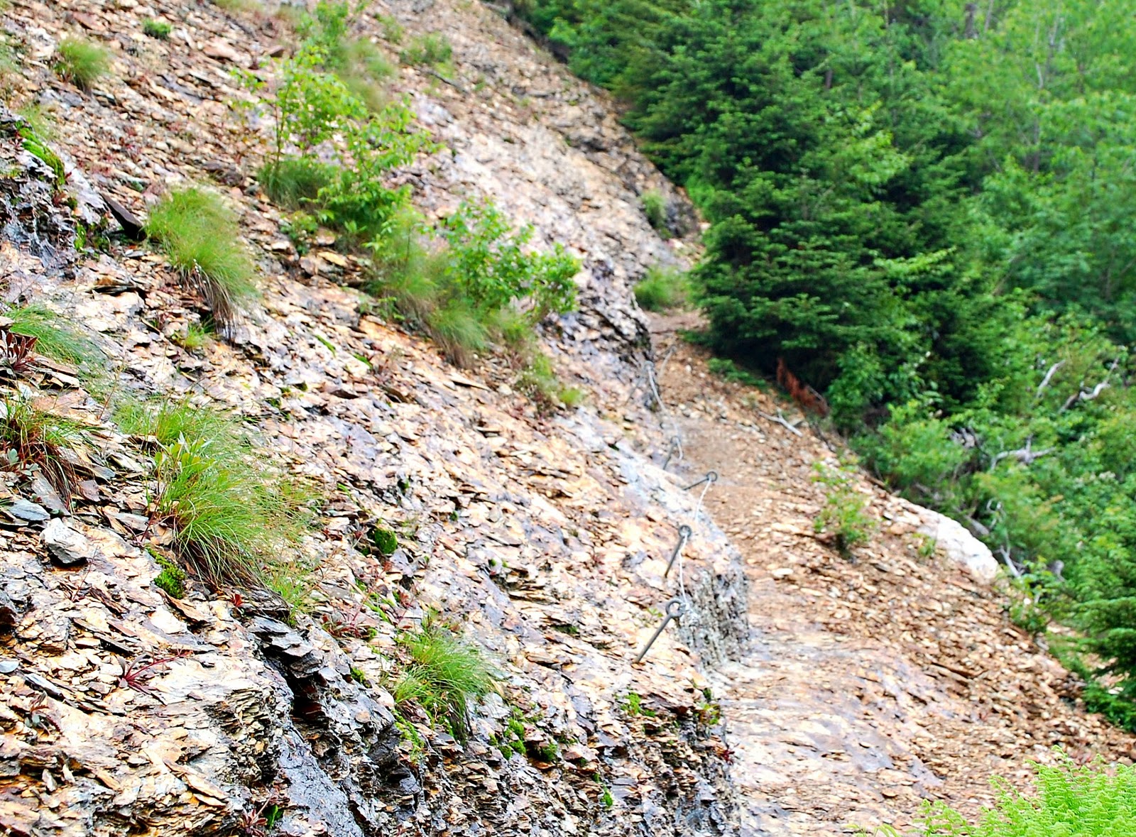
Finally after passing a particularly rocky section with cables to help navigate over wet or icy rocks.........

the lower buildings of the lodge appear ahead.

We head directly to the office to check in and collect our wash bucket and key. There is hot water available at a spigot near the dining room for a sponge bath but you must bring your own towels. How many hotels list wash buckets and kerosene lamps as amenities?

We check the temperature.......

and find our cabin.

Merv coming back with hot chocolate or coffee which is available in the dining hall all day.

While we wait on the dinner bell we wander through the camp. These are some of the crews cabins.


This is where the action is after the sun goes down. Guests come here to warm up by the stove, sit and read, play games, play guitar, and sing. Things people did before TV, computers, and iPhones!

No, there are no bathrooms in those cabins. There is a separate building with flush toilets for guests.

After a delicious dinner of soup, roast beef, mashed potatoes, and green beans, we decide to hike the additional 0.2 miles to Cliff Tops, where everyone gathers for the sunset knowing that most likely there wouldn't be one.


A few minutes earlier we couldn't see any of these mountain ridges.


I could see the sun hiding behind all those clouds but this is the closest we came to a sunset.

We were able to see the lights in Gatlinburg down below us.......

and Pigeon Forge in the distance.

Waiting on the breakfast bell the next morning.

We always look forward to the hearty breakfast they serve of pancakes, eggs, Canadian bacon, grits and biscuits.

We knew there was a 100% chance of rain so we packed up and left right after breakfast.
Some fall color was starting to appear in the upper elevations.


Not a lot of wildflowers bloom in the high elevations at this time of the year, but Grass of Parnassus blooms in August and September in elevations from 4,500 to 6,500 feet.

The highlight of the hike back down was meeting the llama pack on their way up to the lodge.
Three times a week they make the trip up taking fresh linens, food and other supplies. On the return trip they take down the dirty linens and trash. Here is a great little video about the llamas.
Now I know what they do with all the left over pancakes!
Wrangler Alan no longer leads the llama train but he still works at the lodge.

Back at Trillium Gap. 2.8 miles to go. We almost took the time to go up Brushy Mountain, but the fog and threat of rain keeps us moving along. The forecast is calling for several inches of rain.

One more picture at the falls.

And a little cascade down below Grotto Falls.
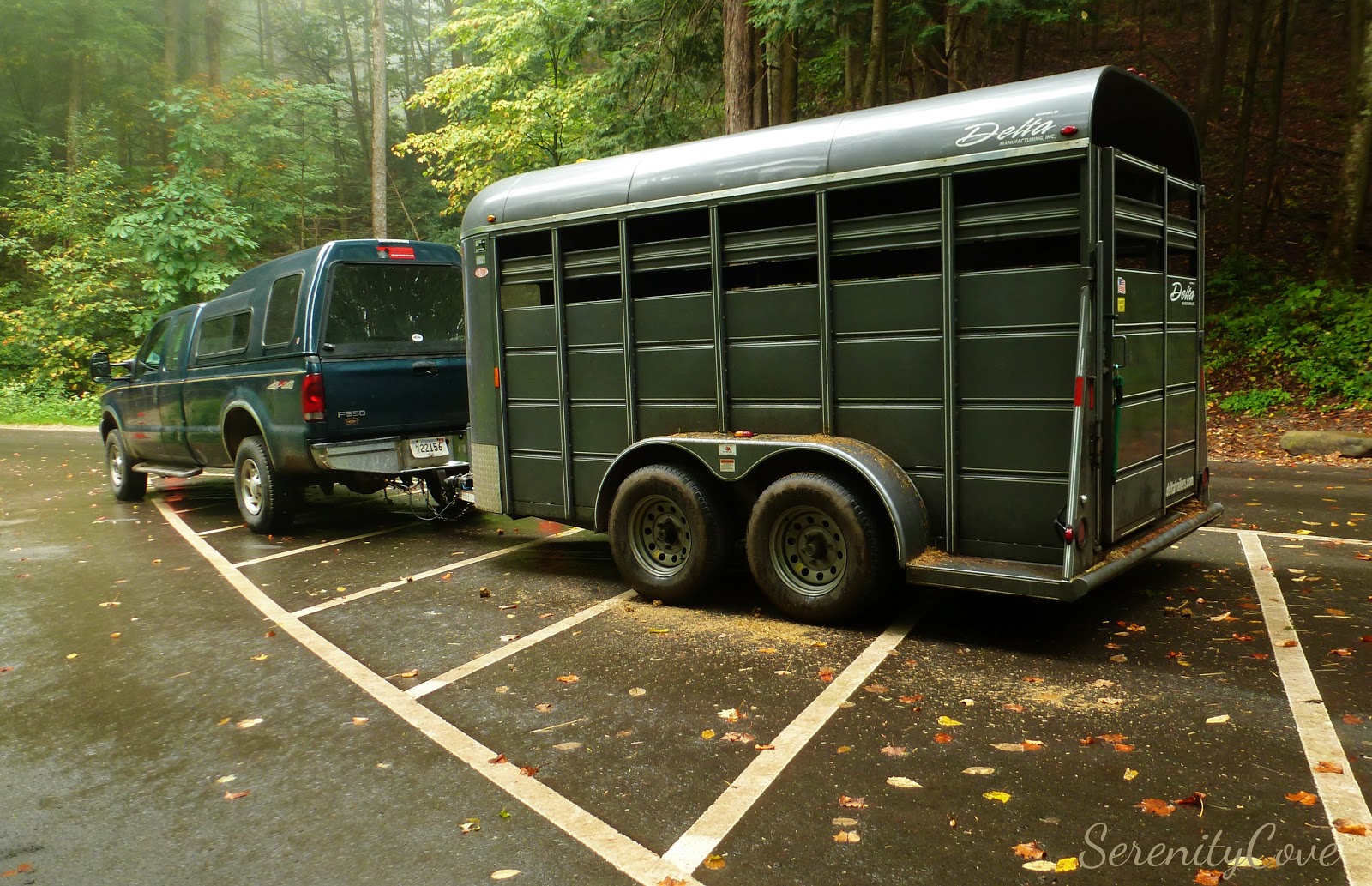
Back at the parking lot the llamas transport have their own reserved space.
We made it down before the worst of the rain came and did it ever come. We were glad our hike was not a day or two later.
Now that we have done all five trails to Mt. LeConte I will rank them in order of preference.
#1. Alum Cave Trail 5.2 miles
Without doubt, Alum Cave Trail is our favorite way to get to LeConte. Not only is it the shortest it's the most scenic. It's a very popular trail therefore it is very crowded, especially up to the Bluff. You get a lot of bang for your buck on this trail. You have Arch Rock, Inspiration Point, and Alum Cave Bluff, plus many views along the way. Other places to look for are, Eye of the Needle, Little and Big Duck Ridges, Dolly Parton Peaks:) and Grassy Slide.If there is a classic hike in the Smokies, Alum Cave would be number one.
Net climb: 2,560 feet
# 2. Trillium Gap Trail 6.7 miles
Trillium Gap comes in second. I think this trail was the easiest, not that any of them are easy. A more gradual elevation gain than Alum Cave. Not a lot of views unless you make the extra trip up to Brushy Mountain. Highlights of this trail are Grotto Falls and meeting the llama pack-train.
Net Climb: 3,300 feet
#3. Rainbow Falls Trail 6.6 miles
#4. Bullhead Trail 7.2 miles
We did the Rainbow Falls Trail and the Bullhead Trail as a loop because they start at the same trailhead. We went up Rainbow and down Bullhead but these two are about a tie in my ranking. I enjoyed Bullhead coming down but would not want to hike up Bullhead. It's very steep and long.
Rainbow Falls has the advantage of having a pretty waterfall along the way but it was so foggy, I don't know if there were any views or not. If I ever did these trails again I would do them the same way. Up Rainbow and down Bullhead.
Net climb: 3,820 feet
#5. Boulevard Trail 8 miles
Definitely my least favorite. It has the least elevation gain because the trail begins at 5,046 feet. Most people assume that this is an easy hike because of the low elevation gain but don't be fooled! This is a very difficult hike. This trail loses and gains elevation many times as the trail goes up and down over ridge after ridge. This was the toughest hike for us.
If you want to add an extra mile to your hike, there is a little side trail to an overlook called the Jumpoff with amazing views of Charlies Bunion and the Appalachian Trail ridge to the east. I recommend doing the Jumpoff on a separate hike which we did when we hiked to Charlies Bunion several years ago.
Net climb: 1,080 feet..... but you do it over and over and over!